Access to the Presset refuge in summer
Treicol car park
Access by car from Arêches.
Altitude: 1703 m
Distance: 4,5 km
Elevation: + 800 m
Time "parking > hut": 2h30
Time "hut > parking": 1h30
GPS coordinates (UTM WGS84) : 32T 315815 5058954
Decimal GPS coordinates: 45.659673 N - 6.635782 E
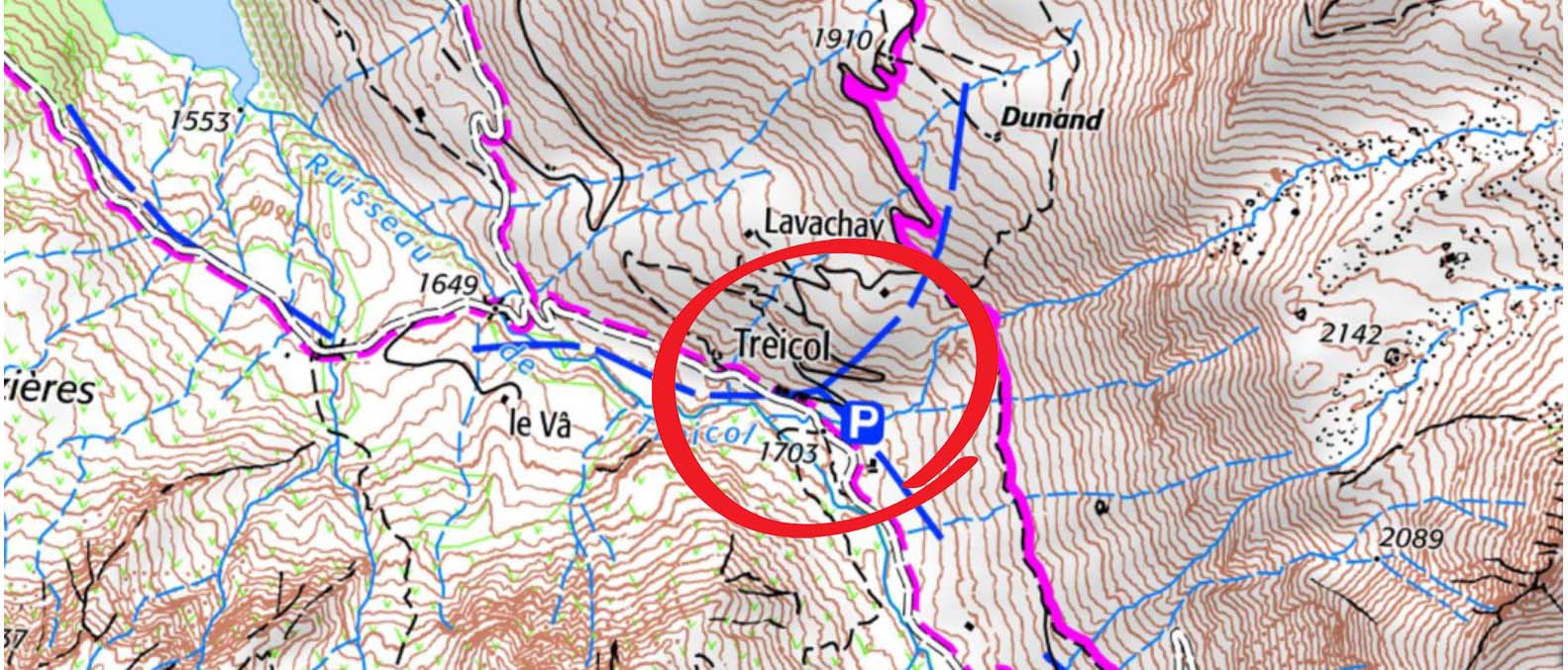 Treicol car park on IGN map
Saint Guérin Chapel car park
Access by car from Aime-la-Plagne - Tarentaise Valley.
Altitude: 1593 m
Distance: 6,5 km
Elevation: + 920 m
Time "parking > hut": 3h00
Time "hut > parking": 1h45
GPS coordinates (UTM WGS84): 32T 318639 5052875
Decimal GPS coordinates: 45.605747 N - 6.674275 E
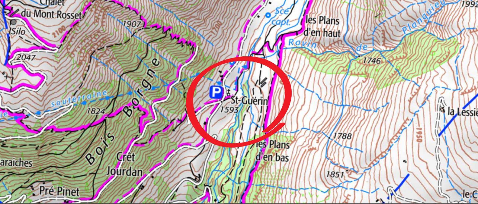 Chapelle Saint-Guérin car park on the IGN map.
Cormet de Roselend car park
Access by car from Arêches or Bourg-Saint-Maurice.
Altitude: 1968 m
Distance: 7,6 km
Elevation: + 800 m ; - 80 m
Time "parking > hut": 2h30
Time "hut > parking": 2h15
GPS coordinates (UTM WGS84) : 32T 315815 5058954
Decimal GPS coordinates: 45.659673 N - 6.635782 E
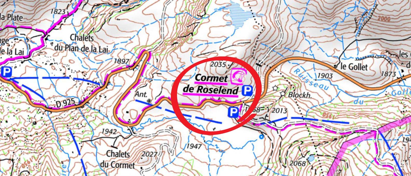 Cormet de Roselend car park on IGN map.
Access to the Presset refuge in winter
")
")